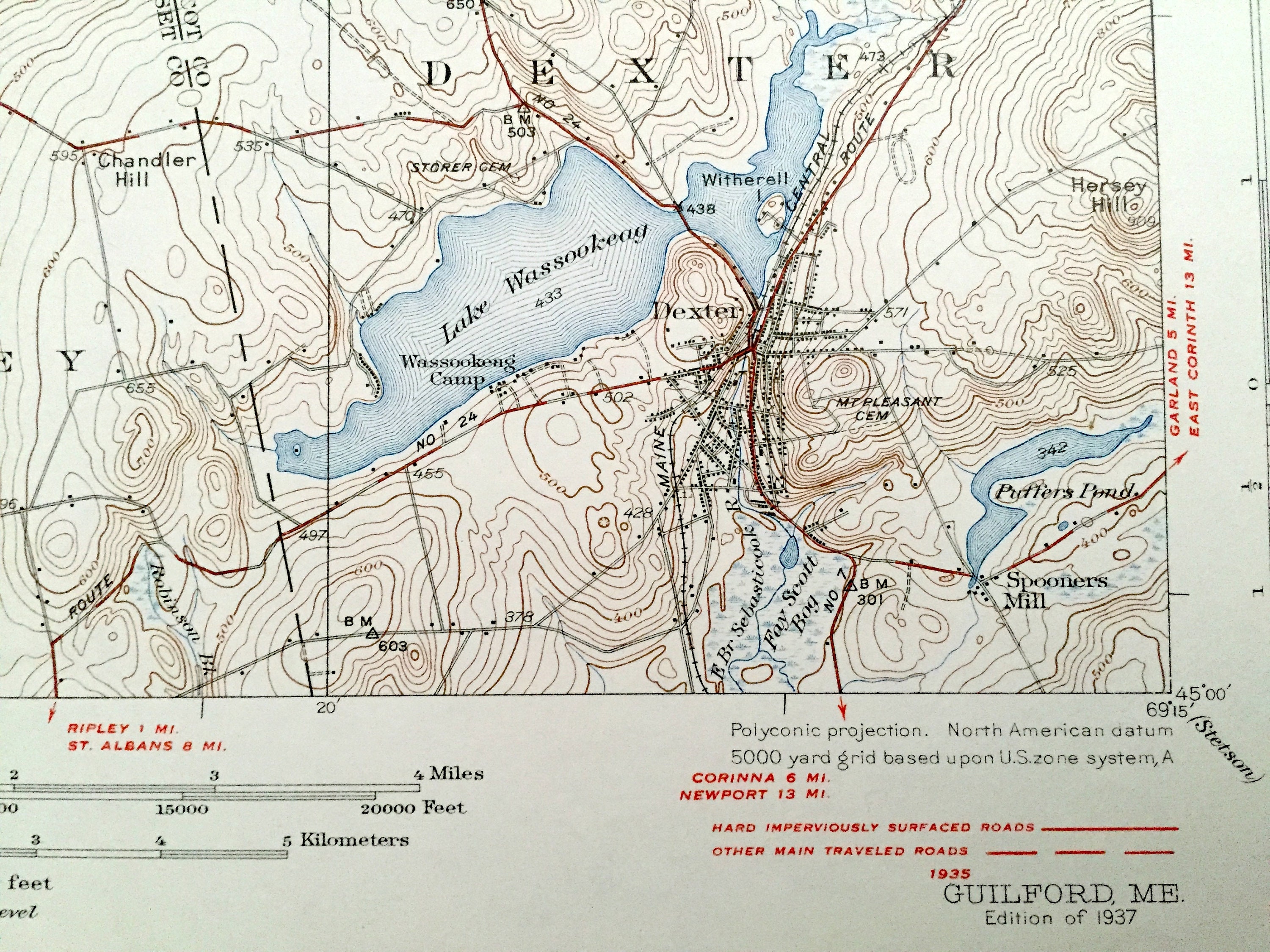

Antique Guilford, Maine 1937 US Geological Survey Topographic Map – authentic Abbot, Dover-Foxcroft, Dexter, Cambridge, Ripley, Sangerville, ME
Beautiful, antique map of Guilford, Maine and surrounding Piscataquis County and Somerset County area on the Piscataquis River. This is an authentic 1937 print from the U.S. Geological Survey and NOT a computer reproduction.
See what Maine looked like over 80 years ago. Lots of intricate details and geological contours. Map even has little squares for every house that existed at the time. The cartographers were very thorough back then! On the back is a description of topographic authentic symbols and map guide.
Perfect for the historian, map-lover, the curious or just as a conversation starter. Wonderful and rare.
Edition of 1937, printed 1937
Dimensions: 16 1/2" width x 20" height
----
Features
Cities & Towns: Monson, Abbot, Guilford, Dover-Foxcroft, Parkman, Sangerville, Willimantic, Cambridge, Ripley, Dexter, Moosehorn, Upper Abbot, Abbot Village, North Guilford, Guilford Center, Dunham Corner, Lows Bridge, Pingree Center, Howard Corner, East Sangerville, Gilman Corner, Wellington, Harmony, Spooners MIll.
Points of Interest: Piscataquis River, Piscataquis County, Somerset County, Penobscot County, Lake Wassookeag, Manhanock Pond, First Davis Pond, Second Davis Pond, Faunce Hill, Brown Hill, Guilford Mountain, Buker Mountain, Flanders Hill, Center Pond, Bean Hill, Sebasticook River, Ripley Pond, and many more streams, ponds, villages, houses, roads, railroads and mountains.
Condition: Very Good Vintage condition, commensurate with age. This map is in great shape for being over 85 years old. Has light wear but this will add to vintage character when framed.
----
We will happily adjust shipping price for multiple purchases.